Hikes in Grand Teton National Park


This is a list/description of some hikes I’ve done in Grand Teton National Park in Wyoming. The first three are relatively flat with minimal elevation change—the others, not so much.
Swan Lake and Heron Pond: This is a great walk if you’re in the Colter Bay area of the park, especially early or late in the day. It’s also a good hike if you’re interested in seeing some wildlife, particularly birds but also with the possibility of spotting a moose. The trail is nearly entirely flat. You start at the end of the parking for the boat launch area and wind for a ways through the woods along the edge of Jackson Lake before leaving the lakeshore. A mile from the trailhead you first reach Heron Pond, and the trail will follow its eastern shore for the next bit, with nice views of the mountains to the west. Heron Pond itself is nearly completely covered with lily pads. At the southern end of the pond you reach an intersection where you take a left and head back in a northeastern direction. In another half-mile or so you reach Swan Lake, where we saw a number of bird species (yes, including a pair of swans with some young) but unfortunately none of the afore-mentioned moose. After following the shore of Swan Lake for several hundred yards, the trail re-enters the trees for the walk back to the trailhead. Total distance for this route is about 3 miles, although there are a number of trails and connectors in this area that would allow you to lengthen and add to the hike if you’d like.
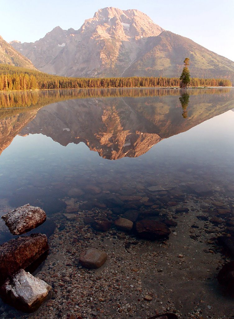
Leigh Lake/Bearpaw Lake/Trapper Lake: This is a nice, mostly-level walk along the eastern shore of a couple of lakes with an option to visit two additional fairly remote lakes. The best part of the hike is that there’s great scenery the whole way, and you can walk as far as you like before choosing to turn around (if you go all the way to the two smaller lakes, the hike is about 4 miles each way). The only drawback is that this is a VERY popular area, so you will have quite a bit of company unless you start at dawn—which, incidentally, is the nicest time to take this hike anyway. The trail starts at the String Lake Picnic Area and heads north along String Lake for most of a mile, with views across the lake to the mountains to the west. At the end of String Lake, the trail briefly leaves sight of water and heads up into the trees (this is really the only section the climbs a bit, although it isn’t really much) before you reach sight of Leigh Lake. For a ways the trail meanders up and down a bit above the lakeshore before eventually descending to the lake level. Most of the time you are close to the water, and there are several sandy beach-type areas where you can stop for a break. (There are also several backcountry campsites that would be good for folks who don’t want to get too far from the trailhead for whatever reason for an overnight stay.) Finally reaching the end of Leigh Lake, the trail is in the trees for a short way before crossing some meadows, then reaching a junction where you choose which of the two remaining lakes (Bearpaw or Trapper) to visit. Once at either, you can make your way to the other, although it requires a sort of hop across an inlet stream. A few more backcountry campsites are found back here. It’s an in-and-out hike, so you return the same way you came—when we hiked this trail we started before sunrise and didn’t see a soul the whole way out, but by the time we headed back we passed a number of people walking the other way. Again, go as early as you can.
Glade Creek: This is a good choice if you want either of two things—first, something “different” in the way of Teton hikes, or second, some loneliness. When I hiked this trail there was one other car at the trailhead, and whoever it belonged to evidently went further than I did, because I didn’t see a single person the whole way out or back. Just be warned, this area can get fairly buggy, so bring the spray. The trailhead is actually outside of the national park, in the Rockefeller Memorial Parkway between the Teton and Yellowstone national park boundaries. From the Parkway road, make the turn for Flagg Ranch and then immediately turn right to continue on Grassy Lake Road. Follow the dirt road (not a problem for cars) for a bit less than 4 and a half miles, then park at the trailhead on the left (south) side of the road. The trail starts off going through a lodgepole forest that burned several years ago, which makes for an interesting walk (although a bit warm on sunny days). It stays mostly in the trees for close to a couple of miles, making a stream crossing on a footbridge, before dropping down a decent-sized hill into a vast open meadow. From here you can see the Snake River off to the left, flowing into Jackson Lake (the year I hiked this the lake was very low, and was further away than usual), with the mountains off in the distance to the south. You can continue a ways into the meadow if you choose, with a number of copses of trees dotting the area. The trail connects with several others that head west up into the mountains for overnight backpacking jaunts. The trail returns the same way—it’s probably between 4 and 5 miles round-trip, depending on how far you go once you leave the woods and enter the meadow.
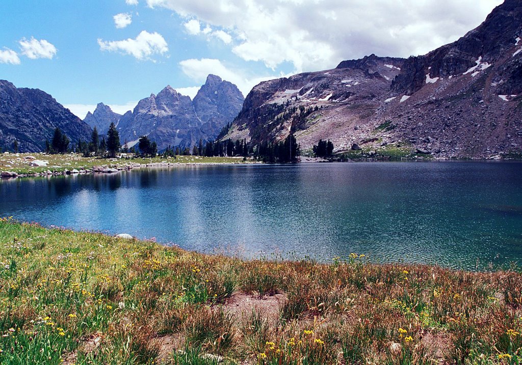
Hidden Falls/Inspiration Point/Cascade Canyon/Lake Solitude: I include all of these destinations in one heading because they all lie on the same route, just a matter of how far you wish to go. Personally I recommend that if you take the time and effort to reach Hidden Falls and Inspiration Point that you continue for at least another mile or two to get a little ways into Cascade Canyon, because it is one of the most beautiful places I’ve ever been. Whether you make the additional effort to reach Lake Solitude is optional, but Cascade Canyon should not be.
The trailhead for this area lies at Jenny Lake. If at all possible, take the ferry boat ride across Jenny Lake—doing so cuts off close to 4 miles off the round-trip mileage, and while the walk around the lake is nice enough I advise that you save your energy for the hike to come. Whichever way you get to the far side of the lake, you will now take a half-mile or so walk up a rocky but not steep trail to Hidden Falls, a very impressive waterfall. Many folks make this their turn-around point, while many others continue to Inspiration Point. The stretch of trail between these two points is probably the “toughest” of the entire hike (if you were to continue all the way to Lake Solitude) and is considerably steeper than the walk to Hidden Falls. Still nothing overly strenuous, though, if you take your time. From Inspiration Point you have a great view to the east out over the lake you crossed and the valley of Jackson Hole beyond.
Now, don’t stop, even if you’re breathing hard from the climb to Inspiration Point. From here the trail is easy and much more level for the next four miles. It does climb steadily but so gently that you barely notice it. The majority of folks turn around at Inspiration Point, but if you continue just another mile you will get some incredible views of Cascade Canyon. At that point, you can turn around or continue hiking along the stream to the spot where the trail “forks.”
At the fork of the canyon, head north (right) to go to Lake Solitude. (Side note: it is worth a short walk of a few hundred yards down the South Fork trail to view a waterfall/cascades.) It is about two and a half additional miles each way to get to the lake, with the trail getting somewhat steeper, especially at the end. The last few hundred yards you climb a moraine before finally arriving at the lake. The stretch between the forks and the lake offers incredible views and lots of wildflowers, but be aware that snow often lingers into July in this area.
All in all, if you are reasonably good shape and have a day to devote to getting into the high country, this is the best introduction you could get to the Grand Tetons. The section leading to Cascade Canyon is not strenuous, and at any point thereafter you can choose to turn around if it turns out to be more than you bargained for. One way distances from the boat dock (add four miles round trip if you don’t take the ferry boat ride) are: half a mile to Hidden Falls, a mile to Inspiration Point, 5 miles to the junction of the North and South Forks trails, and 7 and a half miles to Lake Solitude. You gain a couple hundred feet in altitude getting to the falls, a couple hundred feet more getting to Inspiration Point, and then another 600-700 feet by the time you reach the forks. Continuing on to Lake Solitude takes you up another 1000 feet or so, with the total elevation gain from the trailhead to the lake being about 2300 feet.
Paintbrush Divide: This is the “champion” of the hikes I’ve done in the Tetons from nearly every standpoint, including overall scenery, wildflowers, and difficulty. Doing it as a loop up over the divide and back down past Lake Solitude and through Cascade Canyon makes it about 19 miles (unless you have a way to do a car shuttle, which would allow you to knock off a couple of miles by taking the ferry boat across Jenny Lake). It gains somewhat over 3500 feet, so you will definitely know you’ve been engaged in a workout. It would make an excellent one-or-two-night backpacking trip, if that’s your thing, with some great backcountry camping options. I’ve never cared to carry around that much stuff, though, so I did it as one long day hike, which took me almost exactly 12 hours, starting at 6 a.m. and returning to my car just before 6 p.m. One last warning: the divide itself faces somewhat north, with the result that you will likely be crossing some snowfields even into August (or some years September). All that being said, it’s still worth every step, as the scenery is spectacular.
There are a couple of options as to starting place (and of course, you could do the trail in the opposite direction from what I describe here). It seemed to me the simplest place to begin was the String Lake Picnic Area, same as the trail to Leigh, Bearpaw, and Trapper Lakes described above. From there the first mile is along the shore of String Lake and nicely flat—enjoy it, because it’s the last flat stretch you’re going to see. At the end of String Lake you’ll turn left and cross a bridge over the lake’s inlet stream from Leigh Lake, heading west into the woods. Shortly after you start the long trek upward. The first couple of miles from this point on are mostly in the woods without much in the way of views, but you eventually reach a point where you start alternating stretches through the trees with open breaks that give increasingly impressive views back down the valley to Leigh and Jackson Lakes and the broad valley of Jackson Hole. The trail is not uniformly steep, but alternates between (relatively) gently climbing sections and considerably steeper stretches, as you climb a series of glacial “steps” up the valley.
After quite a ways of this, you finally come to a major “checkpoint” at just under six miles from the trailhead, a junction trail to Holly Lake. A sort of side trail leads (somewhat more steeply) a half mile to this beautiful lake, and (late in the summer, at least) this stretch is filled with wildflowers. Another side trail continues on from the lake and eventually meets back up with the “main trail”—if you stick with the main trail and skip Holly Lake, you will travel a bit more distance but less steeply. I highly recommend visiting Holly Lake, though—it’s a great spot to take an extended break and mull over how far and high you’ve come.
Climbing onward from the lake, you get some of the best views down the valley (see one of the photos) as well as starting to get more open views up toward the divide. You soon begin the seemingly endless slog up switchbacks toward the top—it’s not quite two miles from the lake to the crest of the divide, but trust me, it seems longer. The trail is considerably steeper and rockier here, so watch your footing—especially if, like me, your legs are feeling fairly wooden at this point! (Not to mention the likelihood of patches of snow to cross.)
The views, though, just keep getting more impressive. You can see all the way out to Jackson Hole to the east, and to the north lies the massive form of Mt. Moran. No views of the Grand Teton and its accompanying peaks, though—from here, the looming divide above blocks sight of them.
And then finally, a few more steps, and you are on the top of the divide, eight miles from the trailhead. It is a relatively flat area, so pick a nice spot and have a rest before starting down the other side. When you continue on, you soon come to the spot where the trail starts dropping down toward the North Fork of Cascade Canyon, and here are the views of the Grand Teton that were unavailable before—as well as views of Lake Solitude way below. That’s your next destination, as you wind down switchbacks. The lake seems at times almost close enough to touch, but it’s actually nearly two-and-a-half miles from the divide down to the lake.
Once you reach Lake Solitude (another nice place for a contemplative rest stop), the path down becomes the same as the hike described above, except at the end. Obviously (unless you arranged the afore-mentioned shuttle), your car isn’t parked at Jenny Lake, so you are going to have to hike around the north end of Jenny to reach the trailhead at String Lake. There are a couple of options for doing this: if you haven’t before visited Inspiration Point and/or Hidden Falls, and you have some energy left, you can stay on the “main trail” and hit both of those spots before descending to the boat dock and then heading north along the shore of Jenny Lake. Or, if you prefer, you can pick up a spur trail near the bottom of Cascade Canyon (but before you reach Inspiration Point) that heads north and cuts off close to a mile of distance before joining the Jenny Lake shore trail—this option is somewhat steeper and gives no real views at all (until you reach the lake) as it descends through the trees, but it is shorter. Then, back at your vehicle, pop down a couple of ibuprofen—your legs will thank you for it in the morning.
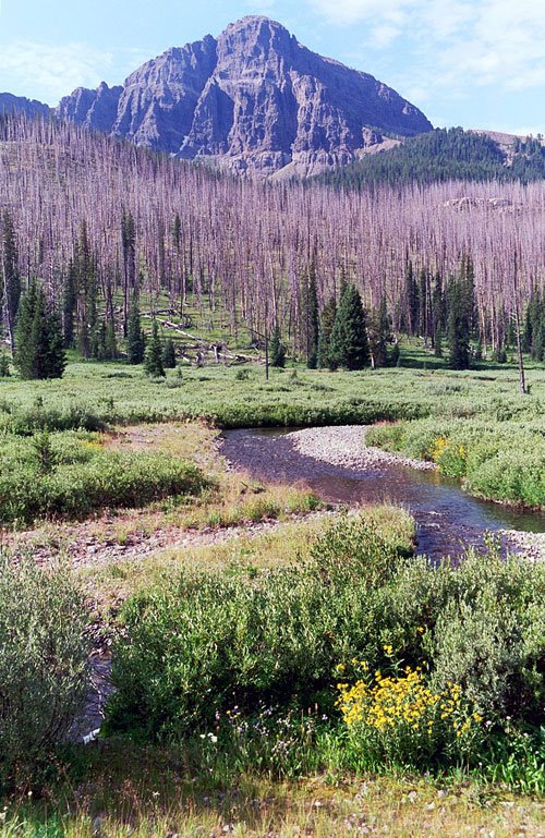
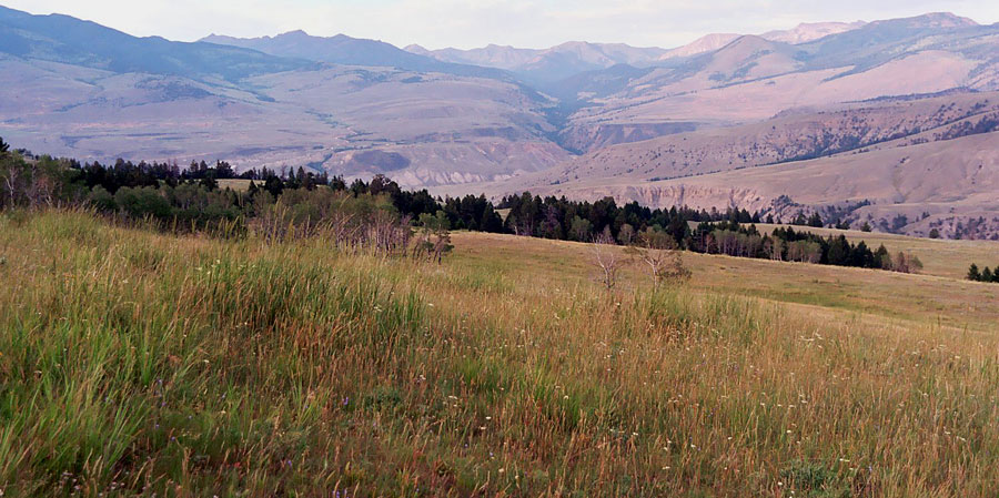
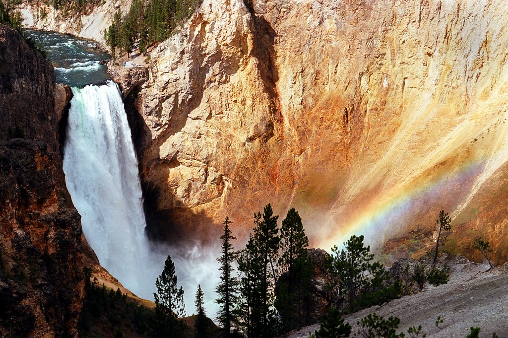
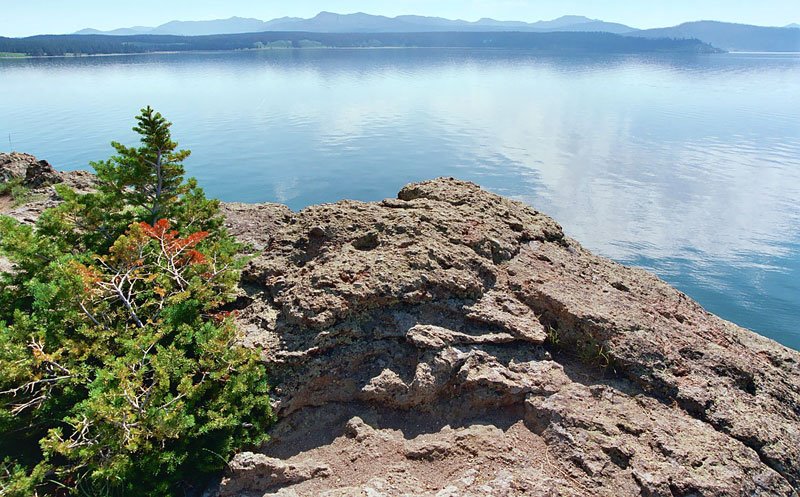
PHOTOS: From the top are Mt. Moran reflected in Leigh Lake; Cascade Canyon; Lake Solitude; Holly Lake (with Jackson Lake, Leigh Lake, and Jackson Hole far off in the distance) along the Paintbrush Divide trail; and some flowers on the way down from Paintbrush Divide into the North Fork of Cascade Canyon.
posted by canyon42 | 12:59 PM
|
0 comments
![]()